m (Please always ensure that your writer template is on your pages in the future.) |
Tag: Source edit |
||
| (61 intermediate revisions by 2 users not shown) | |||
| Line 3: | Line 3: | ||
== Summary == |
== Summary == |
||
| + | A C712F Longsword registered AF 57-586 in service with the United Nations Space Command (UNSC) in affiliation to the Air Force, departed the Troy international spaceport at 13:10 UTC with a filed IFR flight plan to the Caneton Air Force Base. Reported meteorological conditions as per the ATIS at 14:01 UTC indicated heavy thunderstorm activity and an RVR of 1,200 feet at the time. The 2 manned flight crew conducted a category 1 ILS approach with the given conditions towards R/W 09L. Upon attaining an approximate altitude of 2,000 feet MSL, the PM assessed that the craft was not in full L/D configuration and recommended a go-around. During short-final, when the pilots had a visual of the R/W at approximately 200 feet MSL, it was determined that the flight crew was significantly below the glide path and the PF conducted a missed approach procedure upon attaining 100 feet AGL with a pitch angle of approximately 22°. At 14:22 UTC, the craft entered an aerodynamic stall at full power then losing directional control before coming to a rest. Because of the speed and impact, both wings were dismantled from the craft with certain elements producing a 2-meter deep hole into the ground. The crash site debris field was measured to being around 1,900 feet from its initial impact point. The initial emergency response was delayed for 15 minutes due to poor visibility and active military traffic. Emergency responders arrived at the crash site at 14:43 UTC in attempts to control the on-going fire and to aid in the evacuation of the flight crew, but upon reaching the crash site, it was confirmed that the 2 pilots were deceased. |
||
| + | == Meteorological Information 1.0 == |
||
| ⚫ | |||
| − | === |
+ | === General 1.0.1 === |
| + | The afternoon forecast of the 22nd of March 2549 was observed by the Troy international weather observation center. Reported meteorological conditions during the time of the accident predicted an advancing cold front west of Aimsir City. Mandated assessments disclosed by the Troy Aviation Administration (TAA), weather observers, pilots, and the Colonial Civil Aviation Organization (CCAO) advised compulsory and recommended alterations to be made towards the limited and outdated weather observation systems in addition to more sophisticated emplacements to monitor the unpredictable weather patterns on the surface. Troy is documented to be among several UEG established Category 7 planets to sustain advanced weather phenomena relating to multiple weather-related aviation accidents, with Hat Yai being number one. |
||
| − | === |
+ | === Actual Weather 1.0.2 === |
| + | The weather during the time of the crash predicted significant alterations towards a multitude of reported forecasts. Related weather reports as of 14:00 UTC are as follows: winds were foretasted to be variable, but primarily coming from the east at 120° true with a maximum velocity of 25 knots with gusts exceeding 30 knots. The minimum ceiling covered 8/8 oktas of sky coverage at 1,000 feet with a visibility of 3/4SM. Heavy precipitation persisted during the time of the crash associated with thunderstorm activity over the Caneton Air Force Base. The temperature was below zero with a close temperature to dew point spread leading to fog in the vicinity of the aerodrome. Arrivals reported by the ATIS detailed active approaches to R/W 09L with moderate wind shear activity, this resulted in multiple missed approach procedures and diversions. The severity of the storm called for an immediate shutdown of arrivals at 14:30 UTC until the weather deteriorates for safer passage. |
||
| + | === Additional weather Related Information 1.0.3 === |
||
| ⚫ | |||
| + | The area forecast by the Troy international weather observation center behind the advancing cold front indicated there would be light, occasionally moderate icing in cloud. The freezing level would be at the surface, with above-freezing layers between 3,000 and 6000 feet ASL. Furthermore, reported FD's indicated above-freezing temperatures up to and including 9,000 feet ASL. The crew reported that the flight was not in cloud until the final stages of the approach, where they entered the cloud at between 500 and 1,000 feet AGL, and that there were no indications of icing throughout the flight. |
||
| + | |||
| + | === METAR (SPECI) 1.0.4 === |
||
| + | |||
| + | === SPECI TCNN 221415Z 12025G30KT 3/4SM R09L/1200FT/D +RA FG TS OVC010 M03/M01 A2971 WS RWY 09L/R RMK A01 SLP962 === |
||
| + | -refer to the METAR abbreviation sheet for decoding (https://www.weather.gov/media/wrh/mesowest/metar_decode_key.pdf) |
||
| + | |||
| + | == Aerodrome Information 1.2 == |
||
| + | |||
| + | === General 1.2.1 === |
||
| + | The Caneton Air Force Base was certified by the Troy Aviation Administration with an IATA code of TCSC as per the CCAO and meets the minimum Civil Air Regulation (CAR) requirements. The aerodrome is located within a class delta airspace with a Zulu class orbital transition zone with respect to 2 control towers with controlled services from 03:00 UTC to 21:00 UTC. The aerodrome operates multiple services in relation to ground services, clearance delivery, orbital transition, tower services, approach/arrival services, and radar services. The aerodrome has a total of 2 (09L/27R, 09R/27L) asphalt R/W, each being 9,000 feet in length with 4 orbital L/D platforms. |
||
| + | |||
| + | === Runway Overview 1.2.2 === |
||
| + | As mentioned, the aerodrome sustains 2 R/W labeled 09L/27R, 09R/27L measuring 9,000 feet in length with an asphalt surface. All R/W is equipped with high-intensity approach lighting with runway alignment indicator lights, threshold and runway end lights, and high-intensity runway edge lights. The intensity of these light systems can be varied from a setting of 1 to 5, with the lights brightest at setting 5. Both R/W are equipped with an ILS array system providing horizontal guidance and a glide slope antenna providing vertical guidance for arrivals. The aerodrome is also certified to conduct category 1 ILS approaches. An ice-control crew was on duty during the afternoon of the occurrence for R/W 09L. The last full runway length James Brake Index (JBI) reading on runway 15 had been completed about 50 minutes prior to the arrival of AF 57-586; the JBI was .48. At the time, the runway was 60 percent bare and dry and 40 percent covered with ice patches. |
||
| + | |||
| + | == GATL1-C712F Longsword Overview 1.3 == |
||
| + | |||
| + | === Class 1.3.1 === |
||
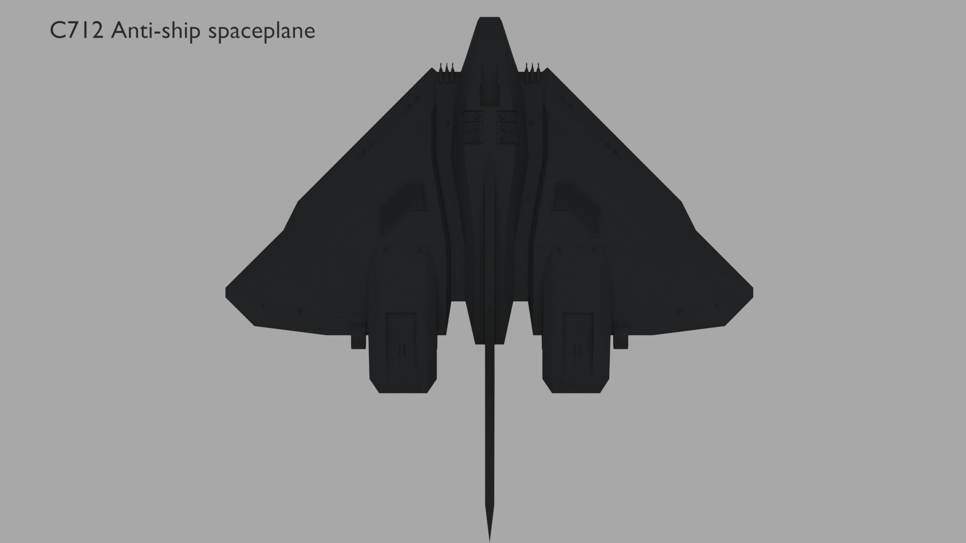
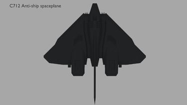
| + | The craft that was operated during the 22nd of March 2549 was GATL1-C712F Longsword in service with the UNSC Air Force registered AF 57-586. The C712 Longsword is capable of both atmospheric and exo-atmospheric flight and can be operated remotely or by a 2 manned flight crew consisting of the commander and pilot. The C712 Longsword is the 6th variant of the Longsword program and has several sub-variants incorporated to its class during the human-covenant war, the craft that was involved in the crash was of the F model used widely by the Air Force. It measures a length of 33.5m, 39.4m in width, and 7.15m in height with a BEW of 180 metric tons. This particular class entered widespread production during the covenant war with an estimated 10,000 active units in service with the Air Force, Marine Corps, and Navy. Its small size defeats the capability of carrying additional ordnance towards its internal bomb bay with a variety of its defenses being complemented towards the outer hull, reducing its radar cross-sectional area. |
||
| + | [[File:Gfv.png|thumb|375x375px]] |
||
| + | |||
| + | === History 1.3.2 === |
||
| + | The particular Longsword involved during the crash with the tail registration AF-586 entered service on the 20th of April, 2530. It was constructed at the C712 assembly line at Kenosha Mars by the Misriah Armory. This variant was involved during the Harvest Campaign during 2526-2531 and the battle Vodin in 2532 before being assigned to the 37th Electronic Combat Squadron over Troy on the 1st of December, 2535. Preceding flight crews and maintenance reported multiple snags towards the navigational equipment, particularly the instrument departure and orbital reference system as well as reported issues with the flap retract system. Upon further investigation after the crash, it was determined that the flap setting was in proper operation and that all snags were signed with no concerns to the navigational instruments with references to the FDR. |
||
| + | |||
| + | === Damages 1.3.3 === |
||
| + | The damages sustained after the crash were severe having both wings being dismantled from the craft and hull ruptures towards the upper and lower parts of the hull. The debris field was measured to being around 1900 feet from its initial point of impact. After entering the stall, the pilots lost most directional control before applying maximum power to recover from the stall. The craft attained approximately 200 knots before striking its left-wing onto the R/W removing the wing into 2 separate pieces from the fuselage before going airborne to a maximum altitude of 35 feet and impacting the ground. The craft traveled at a 90° angle on its left side for 400m, then rolling over where the surface of the R/W is parallel to the longitudinal axis of the craft and slamming its right-wing onto the R/W. The impact force the wing struck the ground caused the right-wing to be dismantled from the fuselage. The entire L/D gear assembly was also removed from the craft with the control surfaces such as the inboard flaps, speed breaks, and ailerons being removed after ground contact. The crafts flap selector was found selected to Flap 8 (go-around) position, and the flaps were positioned at about 24 °. It was concluded that the flaps had not had time to move to 8 ° before electrical power to the flaps was lost. The wreckage trail was strewn with electronic equipment and remaining structures from the fuselage, and with the three landing gear and associated structures. The internal compartment mostly remained intact. The bow took most of the damage after impacting headfirst preceding the stall with the tail pointed upwards. Severe deformations can be seen towards the bow. |
||
| + | |||
| + | == Flight Crew 1.4 == |
||
| + | |||
| + | === Commander 1.4.1 === |
||
| + | [[File:Wht.png|thumb|358x358px]] |
||
| + | Jacob Gilmore, a Major of the UNSC Air Force joined the UNSC on May 11th, 2520. Gilmore was a highly experienced pilot with over 7,000 hours total time with half that being on the C712 longsword. Prior to being appointed to the longsword, he was assigned to fly other fighters such as the CF-50 Jaguar and the S-14 Baselard. Gilmore graduated from the UNSC Air Force Academy and obtained a bachelor's in aerospace engineering and physics from the Kingsford Institute of Technology. Furthermore, he was qualified and current on all relevant ratings including both exo-atmospheric and atmospheric flight for several planets including Troy. After several years of experience flying longswords, Gilmore became qualified to carry out the duties of a line indoctrination pilot, training other longsword pilots to fly in harsh environments. At the time of the occurrence, the commander held a valid Category I medical certificate and a Group I instrument rating, in effect until March 2540. His last Pilot Proficiency Check (PPC) was conducted in May 2538 and was valid until January 2539. |
||
| + | |||
| + | === Pilot 1.4.2 === |
||
| + | [[File:Brwn.png|thumb|348x348px]]Jagvir Singh, a first lieutenant of the UNSC Air Force joined the UNSC on February 13th, 2533. He was lesser experienced than the commander with only 1,000 flight hours total time with 200 hours of that on the C712 longsword. A graduate of the UNSC Air Force Academy and the Akilā school of electrical engineering, Sing spent a majority of his flight hours on the D77-TC Pelican before being assigned to the C712 longsword after the class entered mass production. His qualifications on the Longsword were limited with him not yet being current on his exo-atmospheric rating limiting him to only atmospheric flight certified for Troy, Reach, and Earth. Sing's previous test scores made him viable in assuming second in command duties after failing multiple check rides and exams during his career. His prior experiences and education had him assigned to the 37th Electronic Combat Squadron over the planet of Troy. The challenging weather patterns over the planet were nothing like he had faced previously. Despite this, he passed all minimum requirements including both examinations and check rides with first-attempt completion. During the day of the accident, Sing commenced his duties with a valid category 1 medical certification. After a thorough review after the crash, it was determined that his medical history didn't contribute to the crash. |
||
| + | |||
| ⚫ | |||
| + | |||
| + | === Class Of Investigation 1.5.1 === |
||
| + | This was a class 4 type investigation |
||
| + | {| class="article-table" |
||
| + | |Class 4 Occurence |
||
| + | |- |
||
| + | |A class 4 occurrence is a type of investigations in which may involve serious injury(s) or fatalitie(s). There may be a small release of dangerous goods and moderate damage to property and/or environment. The likelihood of identifying new safety lessons and of advancing transportation safety by reducing risks to persons, property, or the environment is low. |
||
| + | |} |
||
| + | |||
| + | === Investigator-In-Charge 1.5.2 === |
||
| + | Dwaipayan Yuzuvendra: Is the lead investigator responsible for leading and assessing all given factors up until and during the time of the crash. The investigative team he had assembled for this case consisted of 3 experienced investigators all of which were among the team responsible for determining the cause of the downing of the national holiday. Before being employed by the CTSB, he was a pilot for the UNSC and for 2 major commercial carriers before joining the CTSB in 2492 and participating in several CTSB investigations. |
||
| + | |||
| ⚫ | |||
| + | |||
| + | ==== Weather 1.5.3.1 ==== |
||
| + | The actual weather at the time of the accident was claimed to be a major contributor leading to the accident. The instrumentations used to help pilots navigate through Troys natural weather patterns did not meet CAR standards. |
||
| + | |||
| + | ==== Operational Issues 1.5.3.2 ==== |
||
| + | shortcut maintenance work had been done to the Longsword registered AF 57-586 which was found to have several inoperative instrumentations and repeated instrumentation related errors because of this. This was found to be a common practice by the Caneton Air Force base maintenance crews as some of these instrumentations were rarely ever used. Additionally, more stall recovery implementations could enable flight crews to easily recover from an aerodynamic stall. |
||
| + | |||
| + | ==== Human Factors 1.5.3.3 ==== |
||
| + | The commander Flying at the time of the accident deviated from UNSC standard operating procedures. It was also discovered that the commander had a history of this type of behavior by his previous colleagues. The commander was found to have underperformed his duties during the final approach phase avoiding sterile cockpit regulations encouraging the other pilot as well. |
||
| + | |||
| + | ==== Emergency Response 1.5.3.4 ==== |
||
| + | The Caneton Air Force Base does not have a roadway system used for airport vehicles to travel from one end to the other, relying heavily upon the aircraft movement area which may be highly active at times. |
||
| + | |||
| + | ==== Pilot Training 1.5.3.5 ==== |
||
| + | The report had found that the pilots at the time of the crash were not fully trained to fly during the intensive weather patterns at Troy. Additional training must be met to better familiarize pilots with UNSC standard operating procedures. |
||
== Public Materials == |
== Public Materials == |
||
=== Audio === |
=== Audio === |
||
| + | ... |
||
=== Images === |
=== Images === |
||
| + | <gallery> |
||
| + | </gallery><gallery> File:SBGR Layout.svg.png|Aerodrome illustration depicting the point of impact |
||
| ⚫ | |||
| + | File:crash 2 done.png|UNSC logo located at the dismantled tail of the craft |
||
| + | file:Craash 1 done.png|Front image depicting the severe hull damages throughout the airframe. |
||
| + | file:Crash 3 done.png| Aerial view a few minutes after the initial emergency response </gallery> |
||
| ⚫ | |||
| + | {| class="article-table" |
||
| + | |Time (UTC) |
||
| + | |Content |
||
| + | |- |
||
| + | |14:17 |
||
| + | CDR. |
||
| + | | |
||
| + | |- |
||
| + | |Pilot |
||
| + | | |
||
| + | |} |
||
== Conclusion == |
== Conclusion == |
||
| − | === |
+ | === Findings === |
| + | # UNSC standard operating procedure (SOP) and practice when flying in flight path angle guidance mode were that, once the craft was past the final approach fix, the flight crews were not required to monitor the aircraft's altitude and distance from the threshold or to make any adjustments to the flight path angle. This practice was not in accordance with the flight crew operating manuals of the UNSC or Misriah Armoury. |
||
| + | # Poor and a lack of communication were exchanged between the flight crew during the final approach phase often deviating from operating procedures and the sterile cockpit rule. As well as constant disagreements by the commander to initiate a go-around by the pilot. |
||
| + | # As per UNSC flight crew practice, once the flight path angle was selected and the aircraft began to descend, the flight crew did not monitor the altitude and distance from the threshold, nor did they make any adjustments to the flight path angle as well as monitoring the airspeed. Additional failure by the flight crew to initially apply a nose-up attitude instead of applying go-around power. |
||
| + | # The approach and runway lights were not changed from setting 4 to setting 5; therefore, these lights were not at their maximum brightness setting during the approach. |
||
| + | # The flight crew's recognition that the aircraft was too low during the approach would have been delayed because of plan continuation bias. |
||
| + | # The operator did not take appropriate measures to preserve all the available data on the flight data recorder and, therefore, failed to meet the requirements of the Colonial Transportation Safety Board Regulations. |
||
| + | # The sequential nature of steps within the go-around procedures, in particular, in directing the pitch adjustment prior to noting the airspeed, the compelling nature of the command bars, and the high level of concentration required when initiating the go-around contributed to the pilot inadequate monitoring of the airspeed during the go-around attempt. |
||
| + | # The flight crew should have deviated to another airport due to the meteorological conditions. The reason why this was not conducted was expressed by the commander from the cockpit voice recorder. |
||
| + | # The initial emergency response was delayed due to weather and the heavy reliance on using the movement area during poor visibility. |
||
| + | # Overall, poor conduct was expressed by the flight crew and the operator which resulted in the crash. |
||
| + | |||
| + | === Safety Action === |
||
| + | The UNSC has submitted a letter to the Troy Aviation Administration requesting that the standard for approach minimums be tied to the approach lighting capability of the runway and that the corrected minimums be published on the approach plates. Furthermore, the UNSC recalled additional training for UNSC flight crews stationed at category 7 planets. |
||
| + | |||
| + | The Troy Aviation Administration has contacted 4 airports in Troy to recommend that they upgrade their approach lighting currently serviced by omnidirectional approach lighting system (ODALS) to simplified short-approach lighting system with runway alignment indicator lights (SSALR) systems. As well as standardize the weather observation installation at all major spaceports. The Caneton Air force base would later have a roadway system for airport vehicles to travel on. |
||
| + | |||
| + | == Glossary (In Given Order) == |
||
| + | ''Coordinated Universal Time ('''UTC''') - The basis for the worldwide system of civil time. It is the primary time standard by which the world regulates clocks and time.'' |
||
| + | |||
| + | ''Instrument Flight Rules ('''IFR''') - Pilot to craft operations utilizing references towards craft instrumentation for guidance.'' |
||
| + | |||
| + | ''Automatic Terminal Information Service ('''ATIS''') - Repeated automated broadcast issued hourly providing weather-related information, runway status, and all relevant information directed to flight crews. '' |
||
| + | |||
| + | ''Runway Visual Range ('''RVR''') - Distance over which a pilot of a craft on the centreline of the runway can see the runway surface markings delineating the runway or identifying its center line. '' |
||
| + | |||
| + | ''Instrument Landing System ('''ILS''') - A precision runway approach aid based on two radio beams which together provide pilots with both vertical and horizontal guidance during an approach to land.'' |
||
| + | |||
| + | ''Runway ('''R/W''') - A movement area at ports intended for departures and arrivals.'' |
||
| + | |||
| + | <nowiki> </nowiki>Means Sea Level ('''MSL''') - An average level of the surface of one or more of Earth's bodies of water from which heights such as elevation may be measured. |
||
| + | |||
| + | ''Pilot Monitoring ('''PM''') - Oversees the actions of the pilot flying and monitors all craft instrumentation data.'' |
||
| + | |||
| + | ''Landing ('''L/D''') - The act of one object making contact towards the surface of another object.'' |
||
| + | |||
| + | Pilot flying ('''PF''') - Responsible in conducting all flight inputs during flight. |
||
| + | |||
| + | Unified Earth Government ('''UEG) '''- Central civilian government that administers Earth and its colonies throughout a portion of the Orion Arm of the Milky Way galaxy. |
||
| + | |||
| + | Statue Miles ('''SM) '''- A unit of measurement that equivalates to 5,280 feet in length. |
||
| + | |||
| + | Upper Winds ('''FD''') - Alphanumeric forecasts of wind and temperature aloft for various altitudes. |
||
| + | |||
| + | Above Ground Level ('''AGL''') - A measurement of height with respect to the surface. |
||
| + | |||
| + | Basic Empty Weight ('''BEW''') - The weight of the aircraft without passengers, baggage or usable fuel. |
||
| + | |||
| + | Flight Data Recorder ('''FDR''') - Electronic recording device placed in an aircraft for the purpose of facilitating the investigation of aviation accidents and incidents. |
||
| + | |||
| + | '' Pilot Report ('''PIREP''') - A report of the actual weather conditions as encountered by pilots. '' |
||
| + | |||
| + | ''Flight Level ('''FL''') - An aircraft's altitude at standard air pressure read by hundreds of feet. '' |
||
Latest revision as of 04:38, 5 October 2020
| This fanfiction article, Colonial transportation safety board-Case B-00134321, was written by Misirah productions. Please do not edit this fiction without the writer's permission. |
Summary
A C712F Longsword registered AF 57-586 in service with the United Nations Space Command (UNSC) in affiliation to the Air Force, departed the Troy international spaceport at 13:10 UTC with a filed IFR flight plan to the Caneton Air Force Base. Reported meteorological conditions as per the ATIS at 14:01 UTC indicated heavy thunderstorm activity and an RVR of 1,200 feet at the time. The 2 manned flight crew conducted a category 1 ILS approach with the given conditions towards R/W 09L. Upon attaining an approximate altitude of 2,000 feet MSL, the PM assessed that the craft was not in full L/D configuration and recommended a go-around. During short-final, when the pilots had a visual of the R/W at approximately 200 feet MSL, it was determined that the flight crew was significantly below the glide path and the PF conducted a missed approach procedure upon attaining 100 feet AGL with a pitch angle of approximately 22°. At 14:22 UTC, the craft entered an aerodynamic stall at full power then losing directional control before coming to a rest. Because of the speed and impact, both wings were dismantled from the craft with certain elements producing a 2-meter deep hole into the ground. The crash site debris field was measured to being around 1,900 feet from its initial impact point. The initial emergency response was delayed for 15 minutes due to poor visibility and active military traffic. Emergency responders arrived at the crash site at 14:43 UTC in attempts to control the on-going fire and to aid in the evacuation of the flight crew, but upon reaching the crash site, it was confirmed that the 2 pilots were deceased.
Meteorological Information 1.0
General 1.0.1
The afternoon forecast of the 22nd of March 2549 was observed by the Troy international weather observation center. Reported meteorological conditions during the time of the accident predicted an advancing cold front west of Aimsir City. Mandated assessments disclosed by the Troy Aviation Administration (TAA), weather observers, pilots, and the Colonial Civil Aviation Organization (CCAO) advised compulsory and recommended alterations to be made towards the limited and outdated weather observation systems in addition to more sophisticated emplacements to monitor the unpredictable weather patterns on the surface. Troy is documented to be among several UEG established Category 7 planets to sustain advanced weather phenomena relating to multiple weather-related aviation accidents, with Hat Yai being number one.
Actual Weather 1.0.2
The weather during the time of the crash predicted significant alterations towards a multitude of reported forecasts. Related weather reports as of 14:00 UTC are as follows: winds were foretasted to be variable, but primarily coming from the east at 120° true with a maximum velocity of 25 knots with gusts exceeding 30 knots. The minimum ceiling covered 8/8 oktas of sky coverage at 1,000 feet with a visibility of 3/4SM. Heavy precipitation persisted during the time of the crash associated with thunderstorm activity over the Caneton Air Force Base. The temperature was below zero with a close temperature to dew point spread leading to fog in the vicinity of the aerodrome. Arrivals reported by the ATIS detailed active approaches to R/W 09L with moderate wind shear activity, this resulted in multiple missed approach procedures and diversions. The severity of the storm called for an immediate shutdown of arrivals at 14:30 UTC until the weather deteriorates for safer passage.
Additional weather Related Information 1.0.3
The area forecast by the Troy international weather observation center behind the advancing cold front indicated there would be light, occasionally moderate icing in cloud. The freezing level would be at the surface, with above-freezing layers between 3,000 and 6000 feet ASL. Furthermore, reported FD's indicated above-freezing temperatures up to and including 9,000 feet ASL. The crew reported that the flight was not in cloud until the final stages of the approach, where they entered the cloud at between 500 and 1,000 feet AGL, and that there were no indications of icing throughout the flight.
METAR (SPECI) 1.0.4
SPECI TCNN 221415Z 12025G30KT 3/4SM R09L/1200FT/D +RA FG TS OVC010 M03/M01 A2971 WS RWY 09L/R RMK A01 SLP962
-refer to the METAR abbreviation sheet for decoding (https://www.weather.gov/media/wrh/mesowest/metar_decode_key.pdf)
Aerodrome Information 1.2
General 1.2.1
The Caneton Air Force Base was certified by the Troy Aviation Administration with an IATA code of TCSC as per the CCAO and meets the minimum Civil Air Regulation (CAR) requirements. The aerodrome is located within a class delta airspace with a Zulu class orbital transition zone with respect to 2 control towers with controlled services from 03:00 UTC to 21:00 UTC. The aerodrome operates multiple services in relation to ground services, clearance delivery, orbital transition, tower services, approach/arrival services, and radar services. The aerodrome has a total of 2 (09L/27R, 09R/27L) asphalt R/W, each being 9,000 feet in length with 4 orbital L/D platforms.
Runway Overview 1.2.2
As mentioned, the aerodrome sustains 2 R/W labeled 09L/27R, 09R/27L measuring 9,000 feet in length with an asphalt surface. All R/W is equipped with high-intensity approach lighting with runway alignment indicator lights, threshold and runway end lights, and high-intensity runway edge lights. The intensity of these light systems can be varied from a setting of 1 to 5, with the lights brightest at setting 5. Both R/W are equipped with an ILS array system providing horizontal guidance and a glide slope antenna providing vertical guidance for arrivals. The aerodrome is also certified to conduct category 1 ILS approaches. An ice-control crew was on duty during the afternoon of the occurrence for R/W 09L. The last full runway length James Brake Index (JBI) reading on runway 15 had been completed about 50 minutes prior to the arrival of AF 57-586; the JBI was .48. At the time, the runway was 60 percent bare and dry and 40 percent covered with ice patches.
GATL1-C712F Longsword Overview 1.3
Class 1.3.1
The craft that was operated during the 22nd of March 2549 was GATL1-C712F Longsword in service with the UNSC Air Force registered AF 57-586. The C712 Longsword is capable of both atmospheric and exo-atmospheric flight and can be operated remotely or by a 2 manned flight crew consisting of the commander and pilot. The C712 Longsword is the 6th variant of the Longsword program and has several sub-variants incorporated to its class during the human-covenant war, the craft that was involved in the crash was of the F model used widely by the Air Force. It measures a length of 33.5m, 39.4m in width, and 7.15m in height with a BEW of 180 metric tons. This particular class entered widespread production during the covenant war with an estimated 10,000 active units in service with the Air Force, Marine Corps, and Navy. Its small size defeats the capability of carrying additional ordnance towards its internal bomb bay with a variety of its defenses being complemented towards the outer hull, reducing its radar cross-sectional area.
History 1.3.2
The particular Longsword involved during the crash with the tail registration AF-586 entered service on the 20th of April, 2530. It was constructed at the C712 assembly line at Kenosha Mars by the Misriah Armory. This variant was involved during the Harvest Campaign during 2526-2531 and the battle Vodin in 2532 before being assigned to the 37th Electronic Combat Squadron over Troy on the 1st of December, 2535. Preceding flight crews and maintenance reported multiple snags towards the navigational equipment, particularly the instrument departure and orbital reference system as well as reported issues with the flap retract system. Upon further investigation after the crash, it was determined that the flap setting was in proper operation and that all snags were signed with no concerns to the navigational instruments with references to the FDR.
Damages 1.3.3
The damages sustained after the crash were severe having both wings being dismantled from the craft and hull ruptures towards the upper and lower parts of the hull. The debris field was measured to being around 1900 feet from its initial point of impact. After entering the stall, the pilots lost most directional control before applying maximum power to recover from the stall. The craft attained approximately 200 knots before striking its left-wing onto the R/W removing the wing into 2 separate pieces from the fuselage before going airborne to a maximum altitude of 35 feet and impacting the ground. The craft traveled at a 90° angle on its left side for 400m, then rolling over where the surface of the R/W is parallel to the longitudinal axis of the craft and slamming its right-wing onto the R/W. The impact force the wing struck the ground caused the right-wing to be dismantled from the fuselage. The entire L/D gear assembly was also removed from the craft with the control surfaces such as the inboard flaps, speed breaks, and ailerons being removed after ground contact. The crafts flap selector was found selected to Flap 8 (go-around) position, and the flaps were positioned at about 24 °. It was concluded that the flaps had not had time to move to 8 ° before electrical power to the flaps was lost. The wreckage trail was strewn with electronic equipment and remaining structures from the fuselage, and with the three landing gear and associated structures. The internal compartment mostly remained intact. The bow took most of the damage after impacting headfirst preceding the stall with the tail pointed upwards. Severe deformations can be seen towards the bow.
Flight Crew 1.4
Commander 1.4.1


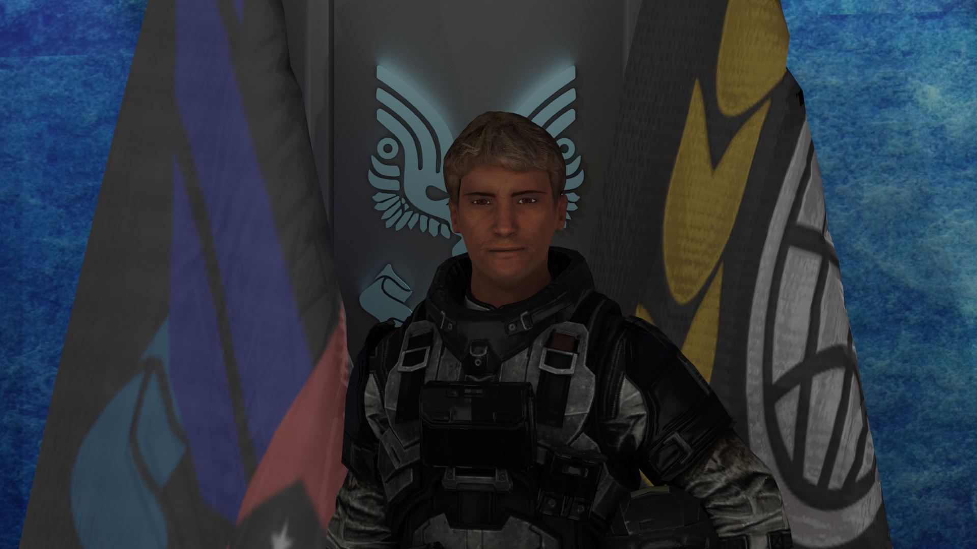
Jacob Gilmore, a Major of the UNSC Air Force joined the UNSC on May 11th, 2520. Gilmore was a highly experienced pilot with over 7,000 hours total time with half that being on the C712 longsword. Prior to being appointed to the longsword, he was assigned to fly other fighters such as the CF-50 Jaguar and the S-14 Baselard. Gilmore graduated from the UNSC Air Force Academy and obtained a bachelor's in aerospace engineering and physics from the Kingsford Institute of Technology. Furthermore, he was qualified and current on all relevant ratings including both exo-atmospheric and atmospheric flight for several planets including Troy. After several years of experience flying longswords, Gilmore became qualified to carry out the duties of a line indoctrination pilot, training other longsword pilots to fly in harsh environments. At the time of the occurrence, the commander held a valid Category I medical certificate and a Group I instrument rating, in effect until March 2540. His last Pilot Proficiency Check (PPC) was conducted in May 2538 and was valid until January 2539.
Pilot 1.4.2

Jagvir Singh, a first lieutenant of the UNSC Air Force joined the UNSC on February 13th, 2533. He was lesser experienced than the commander with only 1,000 flight hours total time with 200 hours of that on the C712 longsword. A graduate of the UNSC Air Force Academy and the Akilā school of electrical engineering, Sing spent a majority of his flight hours on the D77-TC Pelican before being assigned to the C712 longsword after the class entered mass production. His qualifications on the Longsword were limited with him not yet being current on his exo-atmospheric rating limiting him to only atmospheric flight certified for Troy, Reach, and Earth. Sing's previous test scores made him viable in assuming second in command duties after failing multiple check rides and exams during his career. His prior experiences and education had him assigned to the 37th Electronic Combat Squadron over the planet of Troy. The challenging weather patterns over the planet were nothing like he had faced previously. Despite this, he passed all minimum requirements including both examinations and check rides with first-attempt completion. During the day of the accident, Sing commenced his duties with a valid category 1 medical certification. After a thorough review after the crash, it was determined that his medical history didn't contribute to the crash.
Colonial Transportation Safety Board Investigation 1.5
Class Of Investigation 1.5.1
This was a class 4 type investigation
| Class 4 Occurence |
| A class 4 occurrence is a type of investigations in which may involve serious injury(s) or fatalitie(s). There may be a small release of dangerous goods and moderate damage to property and/or environment. The likelihood of identifying new safety lessons and of advancing transportation safety by reducing risks to persons, property, or the environment is low. |
Investigator-In-Charge 1.5.2
Dwaipayan Yuzuvendra: Is the lead investigator responsible for leading and assessing all given factors up until and during the time of the crash. The investigative team he had assembled for this case consisted of 3 experienced investigators all of which were among the team responsible for determining the cause of the downing of the national holiday. Before being employed by the CTSB, he was a pilot for the UNSC and for 2 major commercial carriers before joining the CTSB in 2492 and participating in several CTSB investigations.
Investigation Final Report 1.5.3
Weather 1.5.3.1
The actual weather at the time of the accident was claimed to be a major contributor leading to the accident. The instrumentations used to help pilots navigate through Troys natural weather patterns did not meet CAR standards.
Operational Issues 1.5.3.2
shortcut maintenance work had been done to the Longsword registered AF 57-586 which was found to have several inoperative instrumentations and repeated instrumentation related errors because of this. This was found to be a common practice by the Caneton Air Force base maintenance crews as some of these instrumentations were rarely ever used. Additionally, more stall recovery implementations could enable flight crews to easily recover from an aerodynamic stall.
Human Factors 1.5.3.3
The commander Flying at the time of the accident deviated from UNSC standard operating procedures. It was also discovered that the commander had a history of this type of behavior by his previous colleagues. The commander was found to have underperformed his duties during the final approach phase avoiding sterile cockpit regulations encouraging the other pilot as well.
Emergency Response 1.5.3.4
The Caneton Air Force Base does not have a roadway system used for airport vehicles to travel from one end to the other, relying heavily upon the aircraft movement area which may be highly active at times.
Pilot Training 1.5.3.5
The report had found that the pilots at the time of the crash were not fully trained to fly during the intensive weather patterns at Troy. Additional training must be met to better familiarize pilots with UNSC standard operating procedures.
Public Materials
Audio
...
Images
")
")
")
")
Cockpit Voice Recorder Transcripts
| Time (UTC) | Content |
| 14:17
CDR. |
|
| Pilot |
Conclusion
Findings
- UNSC standard operating procedure (SOP) and practice when flying in flight path angle guidance mode were that, once the craft was past the final approach fix, the flight crews were not required to monitor the aircraft's altitude and distance from the threshold or to make any adjustments to the flight path angle. This practice was not in accordance with the flight crew operating manuals of the UNSC or Misriah Armoury.
- Poor and a lack of communication were exchanged between the flight crew during the final approach phase often deviating from operating procedures and the sterile cockpit rule. As well as constant disagreements by the commander to initiate a go-around by the pilot.
- As per UNSC flight crew practice, once the flight path angle was selected and the aircraft began to descend, the flight crew did not monitor the altitude and distance from the threshold, nor did they make any adjustments to the flight path angle as well as monitoring the airspeed. Additional failure by the flight crew to initially apply a nose-up attitude instead of applying go-around power.
- The approach and runway lights were not changed from setting 4 to setting 5; therefore, these lights were not at their maximum brightness setting during the approach.
- The flight crew's recognition that the aircraft was too low during the approach would have been delayed because of plan continuation bias.
- The operator did not take appropriate measures to preserve all the available data on the flight data recorder and, therefore, failed to meet the requirements of the Colonial Transportation Safety Board Regulations.
- The sequential nature of steps within the go-around procedures, in particular, in directing the pitch adjustment prior to noting the airspeed, the compelling nature of the command bars, and the high level of concentration required when initiating the go-around contributed to the pilot inadequate monitoring of the airspeed during the go-around attempt.
- The flight crew should have deviated to another airport due to the meteorological conditions. The reason why this was not conducted was expressed by the commander from the cockpit voice recorder.
- The initial emergency response was delayed due to weather and the heavy reliance on using the movement area during poor visibility.
- Overall, poor conduct was expressed by the flight crew and the operator which resulted in the crash.
Safety Action
The UNSC has submitted a letter to the Troy Aviation Administration requesting that the standard for approach minimums be tied to the approach lighting capability of the runway and that the corrected minimums be published on the approach plates. Furthermore, the UNSC recalled additional training for UNSC flight crews stationed at category 7 planets.
The Troy Aviation Administration has contacted 4 airports in Troy to recommend that they upgrade their approach lighting currently serviced by omnidirectional approach lighting system (ODALS) to simplified short-approach lighting system with runway alignment indicator lights (SSALR) systems. As well as standardize the weather observation installation at all major spaceports. The Caneton Air force base would later have a roadway system for airport vehicles to travel on.
Glossary (In Given Order)
Coordinated Universal Time (UTC) - The basis for the worldwide system of civil time. It is the primary time standard by which the world regulates clocks and time.
Instrument Flight Rules (IFR) - Pilot to craft operations utilizing references towards craft instrumentation for guidance.
Automatic Terminal Information Service (ATIS) - Repeated automated broadcast issued hourly providing weather-related information, runway status, and all relevant information directed to flight crews.
Runway Visual Range (RVR) - Distance over which a pilot of a craft on the centreline of the runway can see the runway surface markings delineating the runway or identifying its center line.
Instrument Landing System (ILS) - A precision runway approach aid based on two radio beams which together provide pilots with both vertical and horizontal guidance during an approach to land.
Runway (R/W) - A movement area at ports intended for departures and arrivals.
Means Sea Level (MSL) - An average level of the surface of one or more of Earth's bodies of water from which heights such as elevation may be measured.
Pilot Monitoring (PM) - Oversees the actions of the pilot flying and monitors all craft instrumentation data.
Landing (L/D) - The act of one object making contact towards the surface of another object.
Pilot flying (PF) - Responsible in conducting all flight inputs during flight.
Unified Earth Government (UEG) - Central civilian government that administers Earth and its colonies throughout a portion of the Orion Arm of the Milky Way galaxy.
Statue Miles (SM) - A unit of measurement that equivalates to 5,280 feet in length.
Upper Winds (FD) - Alphanumeric forecasts of wind and temperature aloft for various altitudes.
Above Ground Level (AGL) - A measurement of height with respect to the surface.
Basic Empty Weight (BEW) - The weight of the aircraft without passengers, baggage or usable fuel.
Flight Data Recorder (FDR) - Electronic recording device placed in an aircraft for the purpose of facilitating the investigation of aviation accidents and incidents.
Pilot Report (PIREP) - A report of the actual weather conditions as encountered by pilots.
Flight Level (FL) - An aircraft's altitude at standard air pressure read by hundreds of feet.